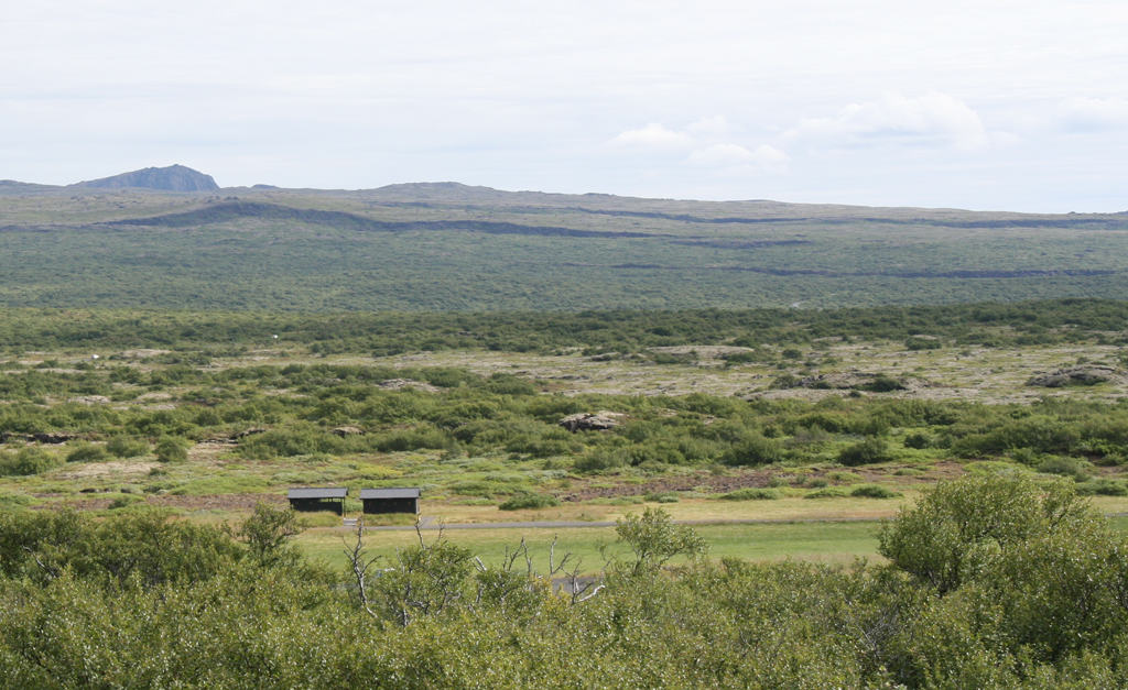
Iceland is splitting apart. One side is moving west, the other side east, and roughly down the middle of the island – if you know what to look for – you can see signs of this process. In the picture above the long, dark features running across the upper part of the photo, looking like great scars on the landscape, are faults, tears in the earth’s crust caused by the pulling apart of Iceland.
There won’t be two Icelands in the future, though. The island will just get bigger; as rapidly as it is splitting apart, new magma wells up to create new territory.
I had read a lot about Iceland’s geology but until recently I had not visited. However, on a recent trip there I was bowled over by the island’s beauty and it’s incredibly diverse volcanic landforms.
Iceland is unique. It exists because it is a geological ‘hotspot,’ a place where a plume of hot material rises slowly from deep in the earth’s interior and generates huge amounts of volcanic lava as it approaches the surface. There are many recognized geological hotspots on the earth – Hawaii is a famous one – but the reason Iceland is unique is because unlike the others it sits astride a spreading ocean ridge: the Mid Atlantic Ridge (MAR).
The MAR runs down the center of the Atlantic Ocean. It is the boundary between tectonic plates, a so-called spreading center along which the plates on either side move away from one another. The ridge is volcanically active – not with explosive volcanic eruptions, but with relatively quiescent outpourings of basalt lava that create new Atlantic seafloor. As a result the Atlantic is getting wider, the continents to the east and west moving farther and farther apart. The process has been going on for almost 200 million years; before that there was no Atlantic Ocean and the continents on either side were joined together.
As you might guess from its name, the Mid Atlantic Ridge rises above the surrounding sea floor. It’s an elevated ridge because of the hot magma that rises beneath it. But it is still submerged; on average the depth to the ridge is about two and a half kilometers. Why then is Iceland, located near the northern end of the Mid Atlantic Ridge, an island? It’s all due to that mantle plume beneath it, which generates the large amounts of additional magma that have made Iceland dry land.
It’s possible to witness Iceland’s splitting apart at a place called Thingvellir, a short excursion from the country’s capital, Reykjavik. Thingvellir is now a national park and a popular stop on the tourist circuit, but long before scientists knew anything about hotspots or moving tectonic plates it was a place of great significance for Iceland’s inhabitants. For over a thousand years Icelanders have held assemblies, parliaments, and national celebrations at Thingvellir. It is spectacular setting, shaped by geology: a wide plain with a river running through it into a large lake, Lake Thingvallavatn, the plain flanked by gently rising topography interrupted by great linear faults where the thick basalt flows have been literally rifted apart.
Here are a few examples of the diverse geological features evident at Thingvellir and other places in Iceland.

Like the picture at the beginning of this musing, this one was taken at Thingvellir. It shows a close-up view of one of the many fractures you can explore there. You can click on this (and the following) images to enlarge.

A famous location at Thingvellir is Law Rock, where chieftains and other leaders addressed assembled followers. Of course in days gone by they didn’t have such a nicely constructed platform; they would have stood on the ground to give their orations. Behind the platform you can see the face of one of the fissures running through Thingvellir. Look closely and you should be able to trace the individual lava flows piled one on top of the other. The forces pulling Iceland apart have produced this cross section of the flows for us.
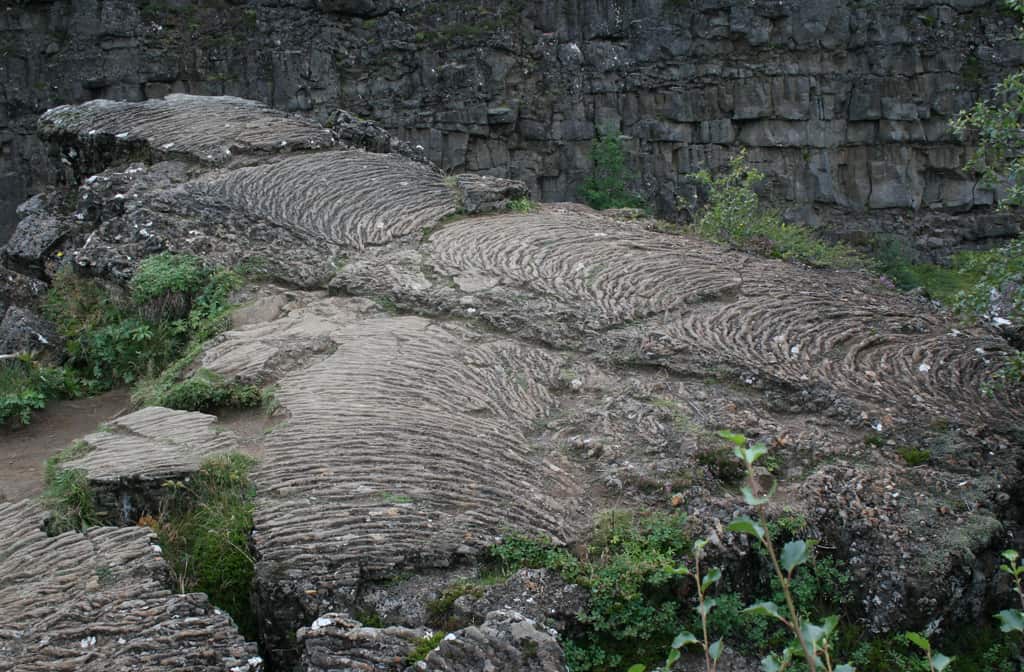
A lava flow with a ‘ropy’ surface texture – geologists usually refer to such flows as ‘pahoehoe’ lava, using a Hawaiian word that has been adopted as a geological term. You can almost imagine this small lobe of viscous lava flowing slowly over the ground.

Another type of lava flow common in Iceland has a very irregular surface – again geologists use a Hawaiian word to describe these flows: ‘a’a. Here the flow is partly covered in moss. When I was a student someone told us that it’s easy to remember which type of lava to call ‘a’a and which to call pahoehoe: if you were to walk on the former, especially with thin shoes, you’d be saying, “ah! ah!”