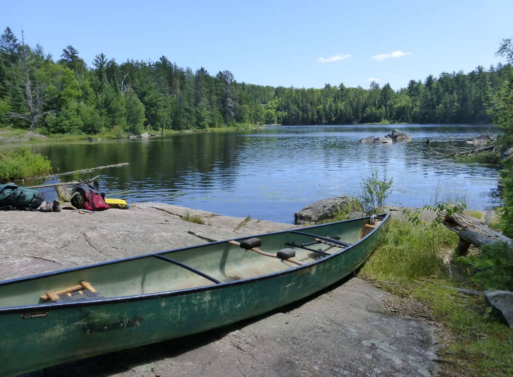
Most of us don’t pay much attention to the rocks under our feet. But portaging a canoe over rough terrain that seems designed to frustrate canoers somehow focuses the mind. Even if you are carrying a modern lightweight Kevlar canoe, you have to think about almost every step. Where do I put my foot next to get up this six foot high rock ledge? Even more problematic, how am I going to get down over the same ledge when we come back a week from now? One slip and you might tumble backward, the canoe on top of you, and twist an ankle. Or even worse, rip a hole in the canoe. So, as you portage, you look very carefully at the rocks under your feet.
That’s what I was doing recently on a canoe trip in Quetico Provincial Park in Ontario, Canada, a lake-filled wilderness park revered by canoers, where motorized vehicles are banned. Of course it’s much less stressful to examine the rocks without a canoe on your shoulders, carrying nothing more than a camera, and I did plenty of that, too.
The landscape of Quetico was shaped by the glaciers of the Pleistocene Ice Age, which repeatedly advanced and retreated through the region over the past million years or so – relatively recently in geological terms – gouging out the myriad lakes of the park, scraping away the topsoil, and sometimes leaving behind patches of ground up rock that have been sifted and sorted by flowing water and now account for the occasional sandy beach you see in the park.
Imagine mile-thick ice, carrying with it embedded fragments of rock and gravel picked up on its journey, flowing over the land and acting like a giant sheet of sandpaper, grinding down the underlying rock. In places you can still see the scratches and grooves that the flowing ice left behind in the bedrock. The last of the ice retreated only about eleven thousand years ago.
But the bedrock, the stone that forms the picturesque rocky points and sheer cliffs of the park, is much older than the topography shaped by the ice age. It is part of the vast Canadian Shield, the core of the North American continent, and in the Quetico region the rocks are almost unimaginably ancient. Most are close to 2.7 billion years old. We know that from numerous dating studies, particularly those using the uranium-lead dating technique described in my book Nature’s Clocks.
So, how were these rocks formed all those billions of years ago? Today, we see them as metamorphic rocks, meaning they have been heated, squeezed, stretched, and generally altered from their original state. But in the part of the park where I was canoeing there are still enough clues in the rocks for geologists to recognize that they were originally sediments, deposited in the sea adjacent to chains of active volcanoes. The sediments were made up mostly of material from those same volcanoes – volcanic ash, for example, as well as rock debris eroded from the volcanoes and carried to the sea by rivers. Similar sediments accumulate today in the Pacific Ocean along the so-called ‘ring of fire,’ the chains of active volcanoes – such as the Aleutians – that lie around the edge of the Pacific basin.

The metamorphism of the Quetico rocks seems to have occurred shortly after the sediments were deposited, close to 2.7 billion years ago, through a process that was probably very similar to the ‘subduction’ that occurs today in plate tectonic collision zones, where ocean plates get dragged down into the earth’s interior and subjected to high pressures and temperatures.
The rocks now exposed in Quetico were heated to high enough temperatures that some components within them began to melt; the melted portions are obvious today as veins or even large expanses of light colored granite or granite-like rock. But some portions of the sedimentary rocks, especially more iron-rich, darker colored rocks, didn’t melt, and in places they appear as rafts of more coherent, dark rocks surrounded by the lighter colored granite. Rocks within rocks.
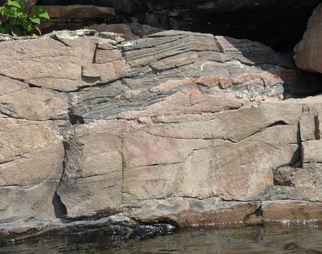
Take a close look at the final photo in this short blurb about Quetico rocks (you may want to click on the photo to enlarge it) and you’ll see an interesting little clue that stretching was one of the phenomena that has affected these rocks. Right in the middle of one of those rafts of dark-colored rocks you can see a band of lighter colored material. But the band isn’t regular, it thickens and thins, especially towards the left hand side of the band. This isn’t a particularly good example of this kind of feature but it’s the only one I noticed on my recent trip. Sometimes, though, you find a rock outcrop with a long string of blobs like this, looking like so many little sausages. Geologists refer to this as ‘boudinage’ structure. In French, ‘boudin’ refers to blood sausage. The boudinage structure is exactly what you would expect if, during metamorphism, a band of rock that had not yet cooled enough to become brittle was stretched (extremely slowly, on a geological timescale). Once rocks become cold and brittle they simply break or fracture if they are stretched, and the boudinage structures don’t form.
It’s amazing what you can learn by looking closely at the rocks under your feet, or in front of your nose.